Three days at Mount Taranaki
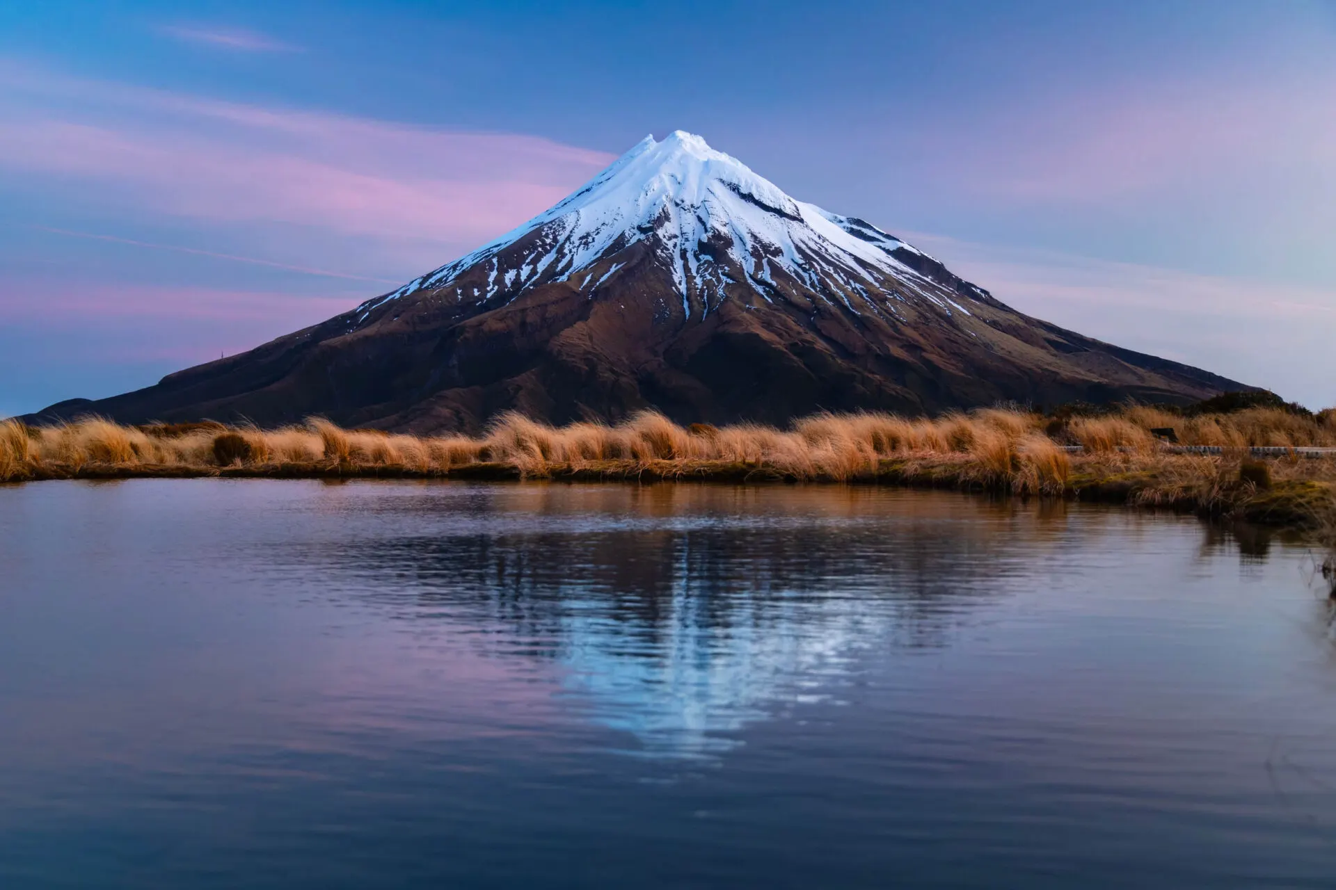
In photos it looks like a volcano from a child's drawing: a perfectly symmetrical cone with a cap of snow rising from flat country. In real life Mount Taranaki is even more striking. I spent three days below it, waited for clear weather and in the end took one of my favourite photos from the whole of New Zealand.
A volcano with a soul
Taranaki (2,518 m) is a stratovolcano on the west coast of the North Island. To Māori it is sacred: legend says it was a warrior who fought the mountain Tongariro for the beautiful mountain Pihanga, lost, and fled west, where it stands alone today and weeps. Since 2025 Taranaki has been a legal person, in recognition of what it means to the local iwi. The land around the volcano is protected as Te Papakura o Taranaki National Park (formerly Egmont).
- New Plymouth – a town with a coastal walkway 39.056° S, 174.075° E
- Pouakai Tarns – tarns with the volcano's reflection 39.213° S, 174.018° E
- North Egmont – visitor centre 39.273° S, 174.100° E
- Mount Taranaki – summit 2,518 m 39.297° S, 174.063° E
- Dawson Falls – waterfall and Wilkies Pools 39.325° S, 174.103° E
Day 1: Pouakai Tarns
The Pouakai Tarns are small pools on a plateau in the Pouakai Range in which, on a still day, the whole volcano is mirrored. The shortest way is from the Mangorei Road car park: about 2–3 hours up steps and boardwalks through rainforest and wetland. The full Pouakai Crossing (19 km) is a day trek with transport needed at both ends.
I got to the top in the afternoon and waited for sunset. The wind dropped, the water went still and the volcano glowed pink. It's worth waiting for that moment.
Day 2: Dawson Falls and Wilkies Pools
On the south-east side of the volcano is the Dawson Falls area. A short walk leads to an 18-metre waterfall, and a little further on to Wilkies Pools: natural pools carved into the lava, where icy mountain water cuts into the rock. The forest around, covered in moss and lichen, is called the Goblin Forest, and it really does look like a forest of goblins.
Day 3: the summit, or the coast
Climbing to the summit of Taranaki is long (8–10 hours) and hard. In summer and good weather a fit hiker can manage it; outside summer it's a mountaineering route with crampons and an ice axe. More people have died on the mountain than you'd expect: the weather here changes within minutes.
If you don't want to go to the summit, spend the day in New Plymouth: the Coastal Walkway, the Te Rewa Rewa Bridge that frames the volcano, and the Pukekura Park gardens.
The road to the volcano
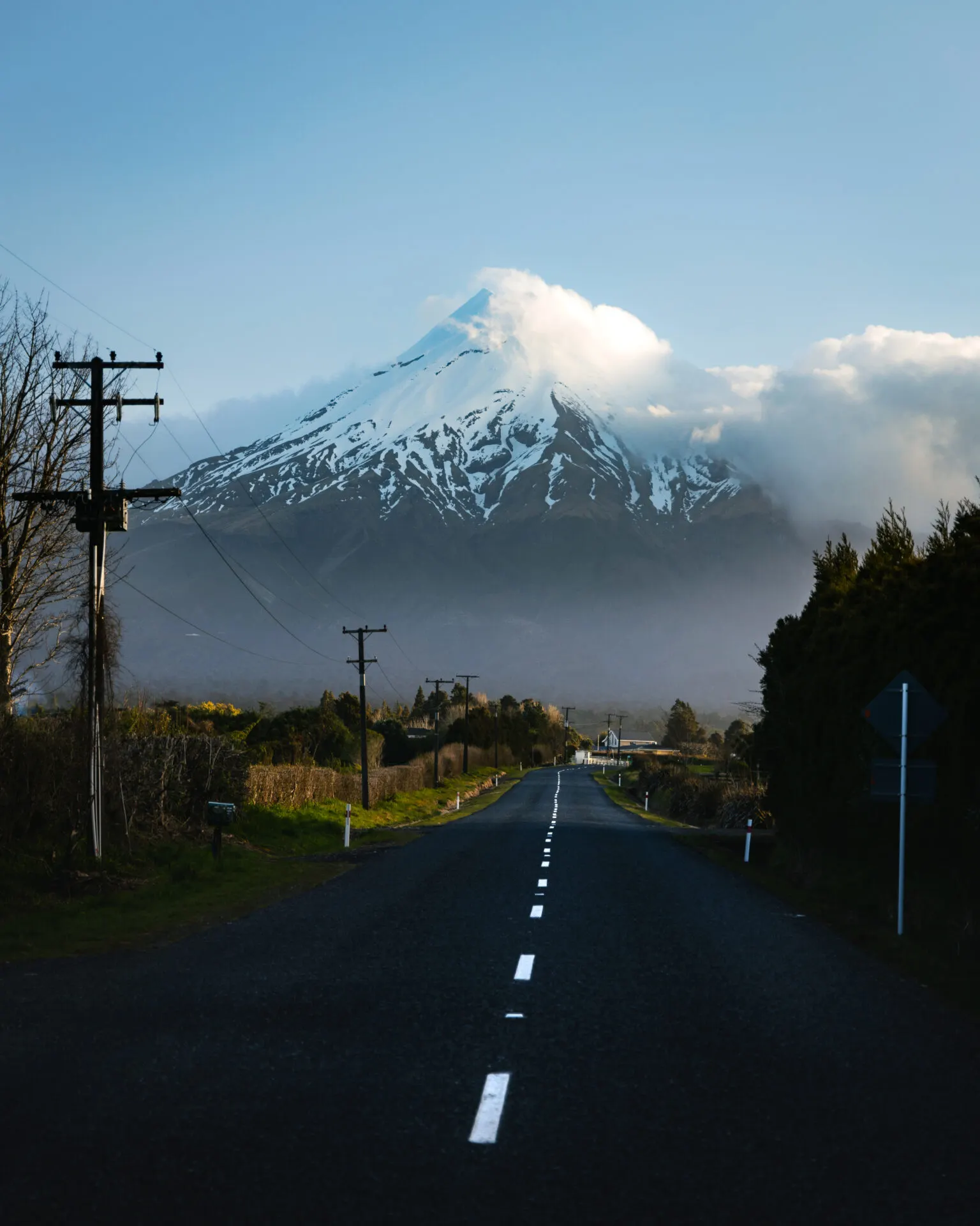
One of my favourite photos I took on the way: a straight road heading directly at the volcano. There are more places like that around Taranaki. Just be careful and only stop where it's safe.
Faq
How long is the hike to the Pouakai Tarns?
From the Mangorei Road car park about 2–3 hours up and 1.5–2 hours down. The full Pouakai Crossing is 19 km and takes 7–9 hours.
When is the best time for Mount Taranaki?
Summer and autumn (December–April). The weather is unpredictable all year, though, so plan a spare day.
Is climbing to the summit of Taranaki safe?
In summer in settled weather, for experienced hikers, yes. Outside summer it's an alpine route with a risk of falls and avalanches.